Weekend Warmth Offers Brief Relief Before Arctic Air Invades
Residents across the region can enjoy a short period of milder temperatures this weekend, but meteorologists warn that the respite will be fleeting. According to senior meteorologist Matt Taylor, a powerful Arctic cold front is set to sweep through early next week, bringing a dramatic drop in temperature and a surge of winter‑like conditions.
High pressure building over the southern plains will usher in southerly winds that push warmer air northward, allowing daytime highs to climb into the mid‑60s Fahrenheit (around 18‑20°C) in many areas. This temporary warm spell is expected to be most pronounced on Saturday and Sunday, with evenings remaining cool but comfortable, ranging from the mid‑40s to low‑50s Fahrenheit (7‑12°C).
Key Weather Highlights for the Weekend
• Saturday: Mostly sunny skies dominate, with sunshine breaking through the lingering cloud cover from earlier in the week. Temperatures will rise to 64‑68°F (18‑20°C) in the central and eastern portions of the region, while western areas see slightly cooler readings of 60‑63°F (15‑17°C). Light winds from the southwest will keep the atmosphere breezy but pleasant.
• Sunday: A lingering ridge of high pressure continues to deliver ample sunshine. Highs will be comparable to Saturday, with a narrow band of low‑level moisture moving in from the Gulf, potentially producing isolated showers near the coastline in the late afternoon. The rest of the interior will stay dry.
• Nighttime Temperatures: Both nights will see lows in the mid‑40s to low‑50s, providing a cool but not uncomfortable end to the warm days. Frost is unlikely in most populated areas, although higher elevations may experience light freeze‑up.
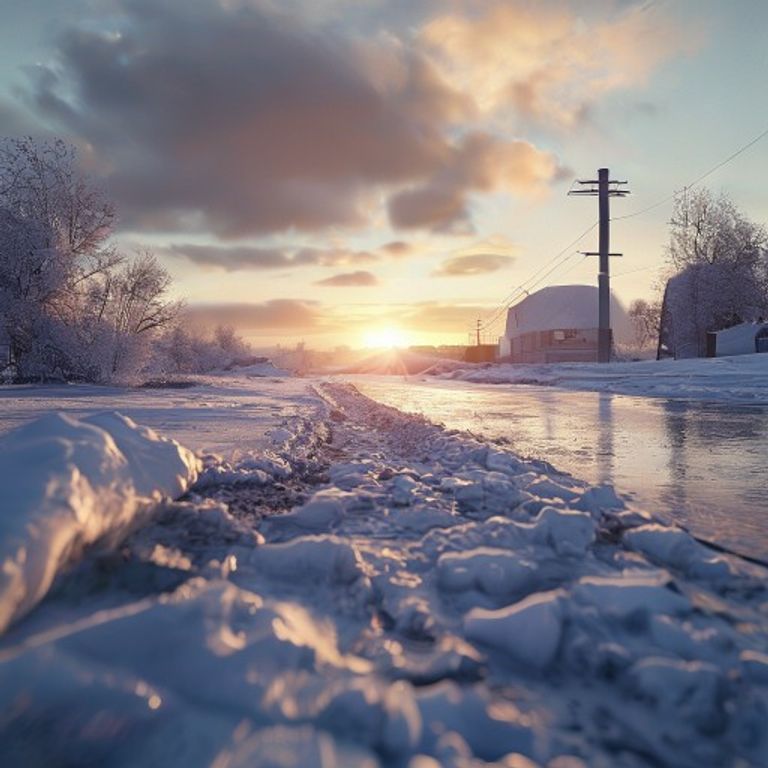
Arctic Front Arrival: A Sharp Temperature Plunge
Matt Taylor emphasizes that the weekend’s mildness is essentially a “weather sandwich” – a brief warm filling between two cold layers. The Arctic front, which is currently strengthening over the northern Great Plains, is projected to surge eastward early Monday morning. As the front advances, it will replace the warm air mass with frigid arctic air, causing a rapid temperature decline.
Monday’s forecast calls for a dramatic shift. Expect strong northwesterly winds, gusts up to 30‑40 mph (48‑64 km/h) in exposed locations, and a sharp drop in high temperatures to the low‑40s Fahrenheit (4‑5°C) across the interior. Coastal areas will be somewhat moderated by the ocean, but highs will still struggle to reach the mid‑50s (12‑13°C). The wind chill factor will make it feel even colder, especially in the early morning and late evening hours.
What the Cold Spell Means for Daily Life
• Travel: Snow‑plowing crews are on standby as the cold front may bring a mix of snow and sleet, particularly in higher terrain and northern counties. Drivers should anticipate reduced visibility and icy road conditions, especially during the first 24‑48 hours after the front’s arrival.
• Energy Consumption: With temperatures expected to plunge below freezing, natural gas and electricity demand will rise as households turn up heating systems. Residents are advised to check furnace filters and ensure that backup heating sources are functional.
• Health: The rapid temperature change can pose risks for vulnerable populations, particularly the elderly and those with respiratory conditions. Health officials recommend limiting time outdoors during the first cold days and dressing in layered, insulated clothing.
Impact on Agriculture and Outdoor Activities
The brief weekend warmth gave a short reprieve to farmers who were concerned about frost damage to early‑season crops. However, the impending cold spell could threaten sensitive vegetation, especially seedlings and newly sprouted beans. Agricultural extension services are urging growers to cover crops with frost blankets or employ windbreaks to mitigate damage.
Outdoor enthusiasts planning hikes, bike rides, or fishing trips should finish any high‑exposure activities before Monday. After the front’s arrival, trail conditions may become icy, and water bodies could see surface ice formation, making recreation hazardous.
Long‑Term Outlook: When Will Temperatures Recover?
Following the Arctic blast, the pattern is expected to remain chilly for the remainder of the week. A secondary trough moving in from the Pacific will sustain the cold air mass, keeping highs in the 30s and 40s (1‑9°C) through Thursday. A more gradual warming trend is projected for the weekend after next, as another ridge builds over the central United States, allowing temperatures to inch back toward the 50s and low 60s Fahrenheit (10‑16°C).
Matt Taylor notes that this type of back‑to‑back temperature swing is typical for late fall, when the jet stream frequently waves between the polar and subtropical realms. Residents should stay tuned to local forecasts and be prepared for rapid weather changes.
Tips for Staying Safe During the Cold Surge
- Check heating systems and have an emergency kit ready.
- Keep an eye on road conditions and avoid travel during the peak of the cold front.
- Dress in layers, covering extremities with hats, gloves, and insulated boots.
- Protect plants by covering them or moving potted varieties indoors.
- Stay informed by following regular updates from the National Weather Service and local meteorologists like Matt Taylor.
In summary, while the upcoming weekend promises a welcomed stretch of milder weather, the real story lies ahead. An Arctic cold front will soon dominate the forecast, ushering in a period of cold, windy, and potentially hazardous conditions. Preparation and vigilance will be key to navigating the transition safely and comfortably.